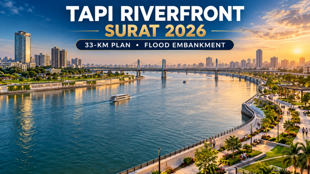
Updated: October 2, 2026. Surat’s Tapi Riverfront project is often described through one headline number or one construction package, but the official plan is much larger than a beautification project.
Surat Municipal Corporation describes the Tapi Riverfront Development and Rejuvenation Project as an approximately 33-kilometre river corridor running from Kathore Bridge on the highway side to the Rundh–Bhatha area. The plan combines flood protection, river cleaning, access, public spaces and water management.
BCC has previously covered the ₹1,250-crore Tapi riverfront embankment approval. This article takes a different search question: what is the full Tapi Riverfront Surat plan, why are embankments needed, and what should residents watch as the project moves ahead?
Key takeaways
- SMC’s official concept covers about 33 km from Kathore Bridge to Rundh–Bhatha.
- Flood protection is a core part of the plan, not a side feature.
- The river faces tidal backflow, flood risk, polluted outfalls and water-retention challenges.
- SMC proposes embankments along both riverbanks, public access and green/recreational areas.
- The master plan is intended to connect with projects such as Tapi Shuddhikaran, riverfront parks, heritage redevelopment and barrage-related planning.
- Execution, maintenance and flood resilience will be more important than visual design alone.
What is the Tapi Riverfront Development Project?
SMC’s project note describes a comprehensive development of the Tapi through Surat rather than one isolated riverbank park. The proposed corridor is approximately 33 km long.
The city’s stated goals include cleaning the river, improving public access, strengthening river edges, creating continuous public space and improving the ability to retain and manage water.
Why does Surat need flood embankments along the Tapi?
The Tapi is affected by both upstream flood flows and its proximity to the Arabian Sea. SMC notes that tidal saline backflow can travel upstream toward the Singanpore weir. Surat also has a long history of major flood events.
Embankments are therefore intended to strengthen the river edge and help the city accommodate high water levels. They are infrastructure first; the promenade and public-space elements sit on top of that flood-management requirement.
This context matters because BCC has repeatedly reported on overflowing creeks and flood vulnerabilities in Surat.
Is the Tapi Riverfront only about beautification?
No. SMC’s own planning page identifies several underlying problems:
- polluted river water;
- contaminated stormwater outfalls;
- inadequate public access and connectivity;
- difficulty retaining water in sections of the river;
- flood risk;
- slum settlements and land-management challenges along the banks.
The public-realm component—walkways, parks, gathering spaces and recreation—is intended to be integrated with those environmental and engineering works.
What is the proposed 33-km route?
SMC says the project extends roughly from Kathore Bridge (NH) to Rundh–Bhatha. Detailed engineering packages and construction phases can divide that corridor into smaller contracts, so residents should distinguish between the overall master-plan length and the length of any single tender.
How does Tapi Shuddhikaran connect to the riverfront?
A clean riverfront requires more than paved banks. If sewage or polluted stormwater continues entering the Tapi, public-space development cannot solve the water-quality problem.
That is why the concept plan specifically refers to integration with the Tapi Shuddhikaran effort. Intercepting polluted flows and improving treatment infrastructure are central to the environmental side of the project.
What about public parks, walkways and recreation?
SMC’s vision includes a continuous public realm with pedestrian trails, visitor facilities and spaces for gatherings, festivals and performances. If executed well, that could reconnect neighborhoods with a river edge that is currently difficult to access in many places.
But public spaces along a flood-prone river need durable materials, safe evacuation design and maintenance budgets. A riverfront that looks impressive on opening day but deteriorates after monsoon seasons would not meet the resilience goal.
How does the project fit Surat’s 2047 vision?
SMC is presenting infrastructure, mobility, cleanliness and public-space projects as part of a longer-term city transformation. BCC’s Surat 2047 vision analysis argues that the real test is delivery: whether major capital projects improve everyday resilience and services.
The riverfront is one of the clearest examples because it combines environmental restoration, flood engineering and public use in the same corridor.
What should Surat residents watch as construction advances?
Flood modelling and embankment design
River engineering should be judged against realistic high-flow scenarios, not only normal water levels.
Water quality
Visible riverfront development should be matched by measurable reductions in sewage and polluted outfalls.
Public access
The value of a public riverfront depends on whether residents from multiple neighborhoods can actually reach and use it.
Resettlement and land issues
Any project affecting existing settlements requires transparent, lawful handling of rehabilitation and land rights.
Maintenance
Landscaping, lighting, walkways, flood infrastructure and public amenities all create recurring operating costs after construction ends.
Frequently asked questions
How long is the Tapi Riverfront project in Surat?
SMC’s concept plan describes an approximately 33-km stretch from Kathore Bridge to Rundh–Bhatha.
Is the ₹1,250-crore embankment the whole riverfront project?
No. The embankment package is an important flood-protection component, while the broader riverfront concept also includes cleaning, public space, access and integrated river management.
Why is flood control important for the project?
Surat has historic flood exposure, and the Tapi is affected by large river flows as well as tidal conditions near the Arabian Sea.
Will the project include parks and walkways?
SMC’s master-plan concept includes green and recreational public space, pedestrian trails and visitor facilities.
Sources and further reading
- Surat Municipal Corporation — projects under planning/tendering
- BCC — earlier coverage of the ₹1,250-crore Tapi embankment approval
Follow Buzz Content Corner
For more Surat updates and local explainers, follow Buzz Content Corner (BCC) on Instagram and Facebook.